Deforestation monitoring has evolved significantly over the years with the advancement of cutting-edge technology. From satellite imagery and drones to artificial intelligence and machine learning algorithms, these new frontiers in monitoring have revolutionized the way we track and analyze deforestation activities around the world. These advancements have enabled researchers and policymakers to detect deforestation in real-time, identify illegal logging activities, and measure the impact of deforestation on biodiversity and climate change.
One of the key impacts of these new technologies is the ability to monitor large and remote forested areas more effectively and efficiently. Satellite imagery provides a bird’s eye view of deforestation activities on a global scale, while drones can capture high-resolution images of deforested areas that are inaccessible by traditional means. Additionally, artificial intelligence algorithms can process and analyze vast amounts of data to identify patterns and trends in deforestation activities. In the upcoming sections, we will explore the key takeaways from these cutting-edge technologies and discuss how they are shaping the future of deforestation monitoring efforts.
What you should know
1. Advances in satellite technology, machine learning algorithms, and artificial intelligence are revolutionizing deforestation monitoring. These innovations allow for more precise and timely detection of changes in forest cover, enabling authorities to take swift action against illegal logging.
2. The use of high-resolution satellite imagery combined with automated algorithms is improving the accuracy and efficiency of deforestation monitoring. This technology can identify deforestation hotspots, track forest degradation, and monitor land-use changes in near real-time.
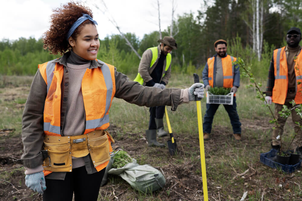
3. Collaborative efforts between governments, non-profit organizations, and technology companies are crucial for effective deforestation monitoring. By sharing data, expertise, and resources, stakeholders can work together to develop more robust monitoring systems and enhance conservation efforts.
4. Public access to deforestation data and monitoring tools is essential for increasing transparency and accountability in forest management. With user-friendly platforms and interactive dashboards, stakeholders can easily access and interpret the latest information on deforestation trends.
5. The integration of cutting-edge technology with traditional field monitoring techniques is one of the approaches to combat deforestation and promote sustainable land management practices. By combining remote sensing data with ground-truthing surveys, stakeholders can verify deforestation alerts and support on-the-ground conservation efforts.
What is the latest technology being used for deforestation monitoring?
**The latest technology being used for deforestation monitoring includes satellite imagery, drones, and artificial intelligence. Satellite imagery provides high-resolution images of forests, allowing researchers to track changes in forest cover over time. Drones are used to capture detailed images of specific areas of interest, providing a closer look at deforestation activities. Artificial intelligence is used to analyze large amounts of data collected from satellite imagery and drones, helping researchers identify patterns of deforestation and predict future deforestation hotspots. These cutting-edge technologies have revolutionized the way deforestation is monitored and have greatly improved our ability to track and combat deforestation.**
Satellite Imagery in Deforestation Monitoring
Satellite imagery has become a crucial tool in monitoring deforestation on a global scale. By capturing high-resolution images of forests from space, researchers can track changes in forest cover over time. This technology allows for the detection of deforestation activities such as clear-cutting, logging, and land conversion. Satellite imagery also enables researchers to monitor deforestation in remote and hard-to-reach areas, providing valuable insights into deforestation trends worldwide.
In addition to monitoring deforestation, satellite imagery can also be used to assess the impact of deforestation on biodiversity, carbon storage, and ecosystem services. By analyzing satellite images, researchers can quantify the extent of deforestation, assess the loss of habitat for wildlife, and estimate the amount of carbon released into the atmosphere. This information is crucial for understanding the environmental consequences of deforestation and developing strategies for conservation and sustainable land use.
Researchers are constantly improving satellite technology to enhance its capabilities for deforestation monitoring. New satellites with higher resolution cameras, improved sensors, and advanced data processing techniques are being launched to provide more detailed and accurate information on deforestation activities. By leveraging these advancements in satellite technology, researchers can better understand the drivers of deforestation, monitor changes in forest cover in real-time, and take timely action to protect forests and biodiversity.
Drones for Deforestation Monitoring
Drones have emerged as a valuable tool for monitoring deforestation at a local scale. These unmanned aerial vehicles can capture detailed images of specific areas of interest, providing a closer look at deforestation activities such as illegal logging, land clearing, and forest degradation. Drones are equipped with high-resolution cameras, GPS technology, and sensors that allow researchers to collect precise data on deforestation in near real-time.
One of the key advantages of using drones for deforestation monitoring is their ability to access remote and inaccessible areas that are difficult to reach by traditional means. Drones can fly over forests, capture images from different angles, and create 3D maps of forested landscapes, providing researchers with valuable insights into deforestation activities. By using drones, researchers can monitor deforestation more efficiently, cost-effectively, and safely compared to traditional ground surveys or aerial photography.
In addition to monitoring deforestation, drones can also be used for reforestation efforts, forest restoration, and conservation initiatives. By deploying drones to plant trees, monitor tree growth, and assess the health of forests, researchers can contribute to the restoration of degraded landscapes and the protection of biodiversity. Drones offer a versatile and innovative approach to deforestation monitoring and conservation, complementing other monitoring techniques such as satellite imagery and ground surveys.
Artificial Intelligence in Deforestation Monitoring
Artificial intelligence (AI) is revolutionizing deforestation monitoring by enabling researchers to analyze large amounts of data collected from satellite imagery, drones, and other sources. AI algorithms can process and interpret complex data sets, identify patterns of deforestation, and predict future deforestation hotspots with high accuracy. By leveraging AI technology, researchers can automate the analysis of deforestation data, extract valuable insights, and make informed decisions to combat deforestation.
One of the key applications of AI in deforestation monitoring is the development of predictive models that can forecast deforestation trends based on historical data and environmental variables. These models can help researchers anticipate where deforestation is likely to occur, prioritize areas for conservation efforts, and implement targeted interventions to prevent deforestation. AI can also be used to detect illegal logging activities, monitor land use changes, and assess the effectiveness of conservation policies in reducing deforestation rates.
AI-powered tools such as machine learning, deep learning, and computer vision are being increasingly used in deforestation monitoring to enhance the accuracy and efficiency of data analysis. These tools can process large-scale satellite images, identify deforestation patterns, and classify land cover types with high precision. By harnessing the power of AI, researchers can gain valuable insights into deforestation dynamics, improve monitoring capabilities, and support evidence-based decision-making for sustainable forest management.
1. How does cutting-edge technology play a role in monitoring deforestation?
Cutting-edge technology, such as satellite imaging and machine learning algorithms, has revolutionized the way we monitor deforestation. These advanced tools allow us to track changes in forest cover with unprecedented accuracy and speed. By analyzing high-resolution satellite images, researchers can detect deforestation in near real-time, enabling quicker response and intervention to protect forests.
2. What are some of the benefits of using cutting-edge technology for deforestation monitoring?
One of the key benefits of using cutting-edge technology for deforestation monitoring is the ability to cover large areas of land quickly and efficiently. Traditional methods of monitoring, such as ground surveys, can be time-consuming and costly. With satellite imaging and other advanced technologies, researchers can monitor vast stretches of forest from a remote location, saving time and resources. Additionally, the high level of detail provided by these technologies allows for more accurate and precise monitoring of deforestation activities.
3. How accurate are the results obtained from cutting-edge technology in deforestation monitoring?
The results obtained from cutting-edge technology in deforestation monitoring are highly accurate. Satellite imaging, for example, can capture changes in forest cover down to the individual tree level. Machine learning algorithms can analyze these images and detect deforestation with a high degree of precision. By combining multiple sources of data and advanced analytical techniques, researchers can produce reliable and up-to-date information on deforestation activities.
4. What are some of the challenges faced in implementing cutting-edge technology for deforestation monitoring?
While cutting-edge technology offers many advantages for deforestation monitoring, there are also challenges to overcome. One of the main challenges is the cost associated with acquiring and maintaining these technologies. High-resolution satellite images and advanced analytical tools can be expensive to access and use. Additionally, there may be technical barriers, such as limited internet connectivity in remote forest areas, that can hinder the implementation of these technologies. Collaboration between governments, researchers, and technology providers is essential to address these challenges and ensure the effective use of cutting-edge technology for deforestation monitoring.
5. How can cutting-edge technology help in preventing deforestation?
Cutting-edge technology can play a crucial role in preventing deforestation by providing timely and accurate information on forest cover changes. By monitoring deforestation activities in real-time, authorities can take immediate action to stop illegal logging and land clearing. Advanced technologies can also help identify areas at high risk of deforestation, allowing for targeted conservation efforts and sustainable land management practices. By leveraging cutting-edge technology, we can work towards reducing deforestation rates and preserving our valuable forest ecosystems.
6. What are some of the limitations of using cutting-edge technology for deforestation monitoring?
While cutting-edge technology offers many benefits for deforestation monitoring, there are some limitations to consider. For example, satellite imaging may be affected by cloud cover or other atmospheric conditions, which can impact the quality of the data collected. Additionally, the interpretation of satellite images and other data sources may require specialized expertise and training. It is important to consider these limitations when using cutting-edge technology for deforestation monitoring and to complement these tools with other monitoring methods for a comprehensive approach.
7. How can stakeholders, such as governments and NGOs, benefit from cutting-edge technology in deforestation monitoring?
Stakeholders, such as governments and non-governmental organizations (NGOs), can benefit from cutting-edge technology in deforestation monitoring in several ways. By using advanced tools and techniques, stakeholders can improve their ability to track deforestation activities and enforce environmental regulations. Governments can use this information to develop more effective policies and strategies for forest conservation. NGOs can leverage cutting-edge technology to raise awareness about deforestation issues and advocate for sustainable land use practices. Overall, stakeholders can work together to leverage cutting-edge technology for better deforestation monitoring and conservation efforts.
8. How can individuals contribute to deforestation monitoring using cutting-edge technology?
Individuals can contribute to deforestation monitoring using cutting-edge technology by supporting initiatives that use advanced tools for monitoring forest cover changes. By staying informed about deforestation issues and supporting organizations that use cutting-edge technology for monitoring, individuals can help raise awareness and drive positive change. Additionally, individuals can participate in citizen science projects that involve analyzing satellite images or other data sources to track deforestation activities. By taking an active role in deforestation monitoring, individuals can make a meaningful impact in protecting our forests for future generations.
9. What are some examples of successful applications of cutting-edge technology in deforestation monitoring?
There are several examples of successful applications of cutting-edge technology in deforestation monitoring. For instance, Global Forest Watch, a platform that uses satellite imagery and machine learning algorithms, has been instrumental in tracking deforestation activities around the world. Conservation organizations, such as the World Resources Institute and the Rainforest Alliance, have also used advanced technologies to monitor forest cover changes and implement conservation projects. These successful applications demonstrate the power of cutting-edge technology in improving deforestation monitoring and conservation efforts.
10. How can the use of cutting-edge technology in deforestation monitoring contribute to global sustainability goals?
The use of cutting-edge technology in deforestation monitoring can contribute to global sustainability goals by helping to reduce deforestation rates and promote sustainable land use practices. By providing accurate and timely information on forest cover changes, advanced technologies can support efforts to protect biodiversity, mitigate climate change, and promote sustainable development. By leveraging cutting-edge technology for deforestation monitoring, we can work towards achieving global sustainability goals and ensuring the long-term health and resilience of our forests and ecosystems.


